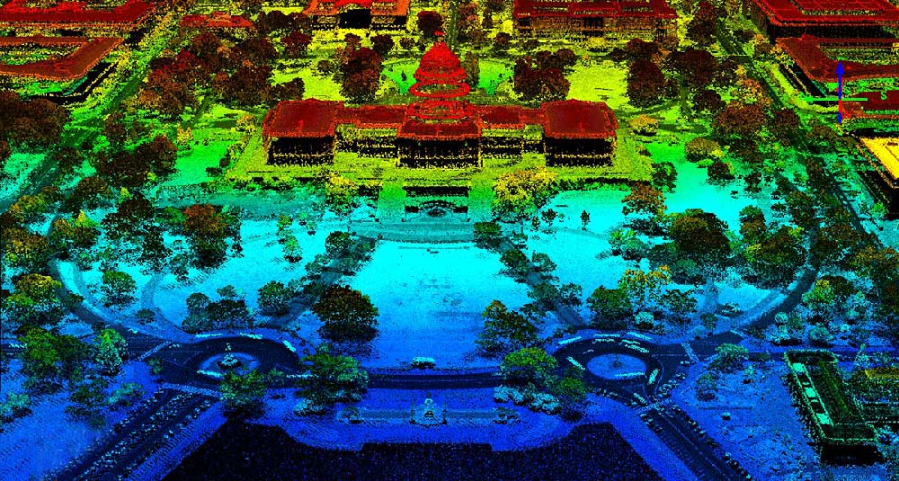
Main Articles Lidar - Wikipedia en.wikipedia.org https://en.wikipedia.org/wiki/Lidar A Complete Guide to LiDAR: Light Detection and Ranging - GIS Geography How would you like to wave your magic wand & find out how far everything is away from you? No magic wands needed with Light Detection and Ranging (LiDAR). GIS Geography https://gisgeography.com/lidar-light-detection-and-ranging/ What is lidar? LIDAR — Light Detection and Ranging — is a remote sensing method used to examine the surface of the Earth. oceanservice.noaa.gov https://oceanservice.noaa.gov/facts/lidar.html Loading... Taking too long? Reload document | Open in new tab Download [1.17 MB] http://frg.berkeley.edu/wp-content/uploads/2018/12/Moosmann_IV09.pdf The Basics of LiDAR - Light Detection and Ranging - Remote Sensing | NSF NEON | Open Data to Understand our Ecosystems LiDAR or Light Detection and Ranging is an active remote sensing system that can be used to measure vegetation height across wide areas. This page will introduce fundamental LiDAR (or lidar) concepts including: www.neonscience.org https://www.neonscience.org/lidar-basics Point cloud - Wikipedia en.wikipedia.org https://en.wikipedia.org/wiki/Point_cloud Supporting Articles LIDAR Explained: What is LIDAR? How LIDAR Works? LIDAR vs RADAR In this video, the overview of LIDAR technology has been given.So, in this video you will learn, What is LIDAR, How LIDAR works, Difference between RADAR and... YouTube https://www.youtube.com/watch?v=uOhD8PYAVF4 How Does LiDAR Remote Sensing Work? Light Detection and Ranging This NEON Science video overviews what lidar or light detection and ranging is, how it works and what types of information it can provide. The video was prod... YouTube https://www.youtube.com/watch?v=EYbhNSUnIdU Basics of Airborne LiDAR (C17, V1) -What is LiDAR?-How is range determined?-What does intensity mean?-First returns vs. last returns-Digital surface model vs. digital terrain model-Point cloud... YouTube https://www.youtube.com/watch?v=GbJ9xPf0gwg Basics of Using LiDAR Data, Lecture 1 Basics of Using LiDAR Data, Lecture 1. From the "Conservation Applications of LiDAR" series. Lecture slides and further training materials are at z.umn.edu/l... YouTube https://www.youtube.com/watch?v=X7130orSz74 Dr. Nicholas Coops: Introduction to LiDAR Technology Dr. Nicholas Coops provides an introduction to LiDAR for forestry and natural resource management. Terrain elevation was the original intent but our capacity... YouTube https://www.youtube.com/watch?v=HfV7jJgrw4Q